Tramo VIII / Part VIII: Laufenburg – Sisseln 6,9 km
ESP / ENG
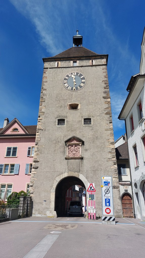
Llegamos a la estación y Tom, Remo y yo nos encontramos con Paloma, con quien partimos para Laufenburg, donde un año antes habíamos terminado nuestra caminata. Esta vez pudimos recorrer una parte de la ciudad medieval, asombrándonos de sus edificios, pero siempre buscando el río. Cuando llegamos a él, comenzó nuestra caminata.
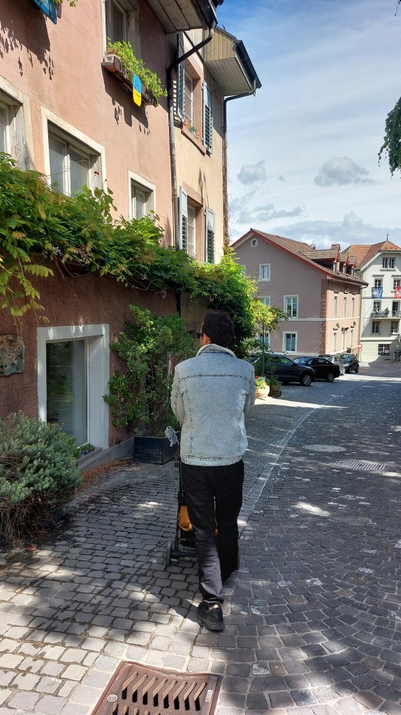
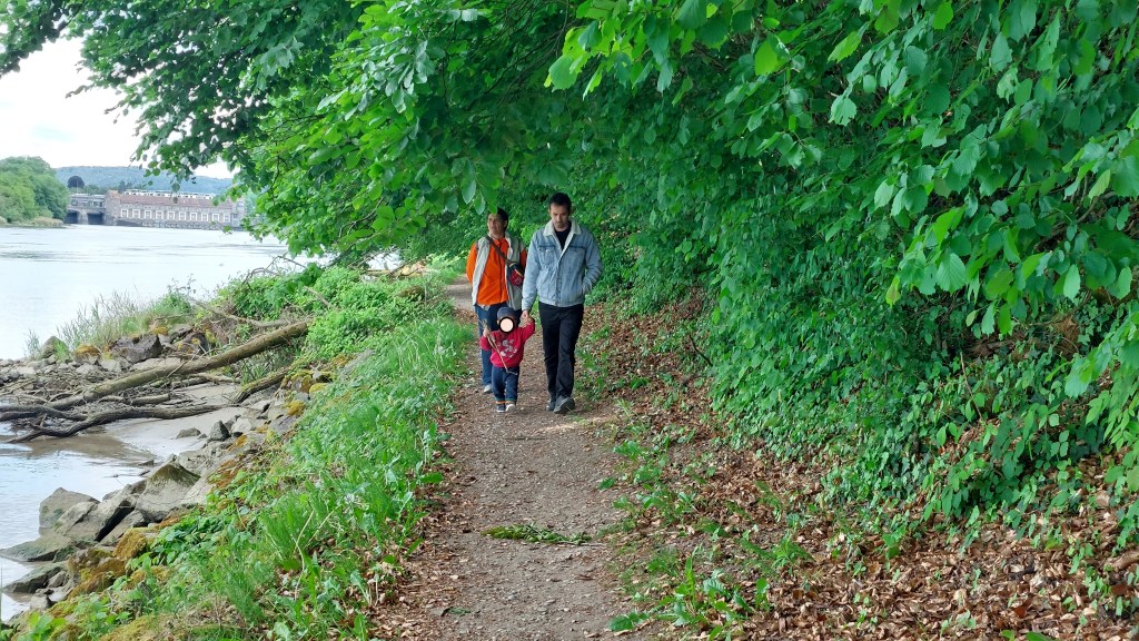
Otra vez la travesía fue condicionada por el hecho de ir con un cochecito. En Laufenburg había algunos caminos accesibles para sillas de ruedas que pudimos disfrutar. Pero luego, se nos presentaron dificultades. En estos días leí en el libro “Andar por andar” de Adriana Herreros: “(las) zonas de paseo (…) en los entornos rurales, se reducen drásticamente conforme avanzan la urbanización, las autopistas y las diferentes infraestructuras”. Me puse a pensar en la dificultad para avanzar con un niño pequeño fuera de la ciudad. En estos senderos no accesibles. Por un lado pienso que es positivo mantener los entornos naturales entre las poblaciones, que no hay necesidad de senderizar todo, que está bien que queden espacios indómitos, o con pretensión de esto por lo menos. Caminos estrechos e inmersivos. Sin embargo, es innegable que estos espacios están atravesados por carreteras asfaltadas, sin aceras, hechas solo para los autos. Con auto, se puede llegar a todas partes. Con auto, se hace este camino junto al río. Siempre que caminamos hubo una carretera más o menos cerca. Pero con un cochecito para niño, la cosa se complica. Entonces, me pregunto si, así como hay disponibilidad para los autos, un sendero más ancho y un poco más aplanado no bastaría para que personas con carritos también puedan caminar junto al río del lado suizo. Me lo pregunto solo porque quiero seguir caminando y explorando teniendo con un niño.
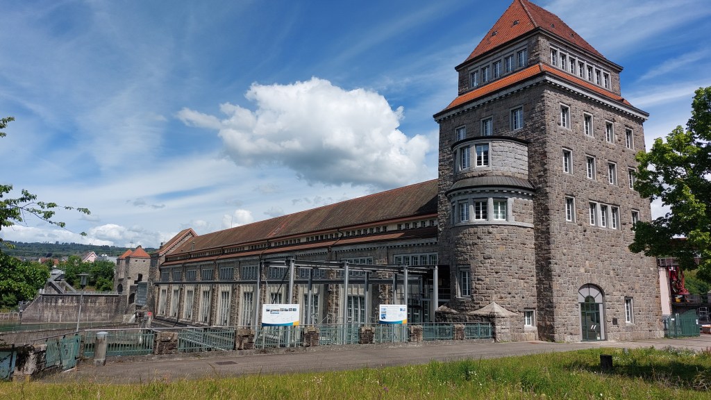
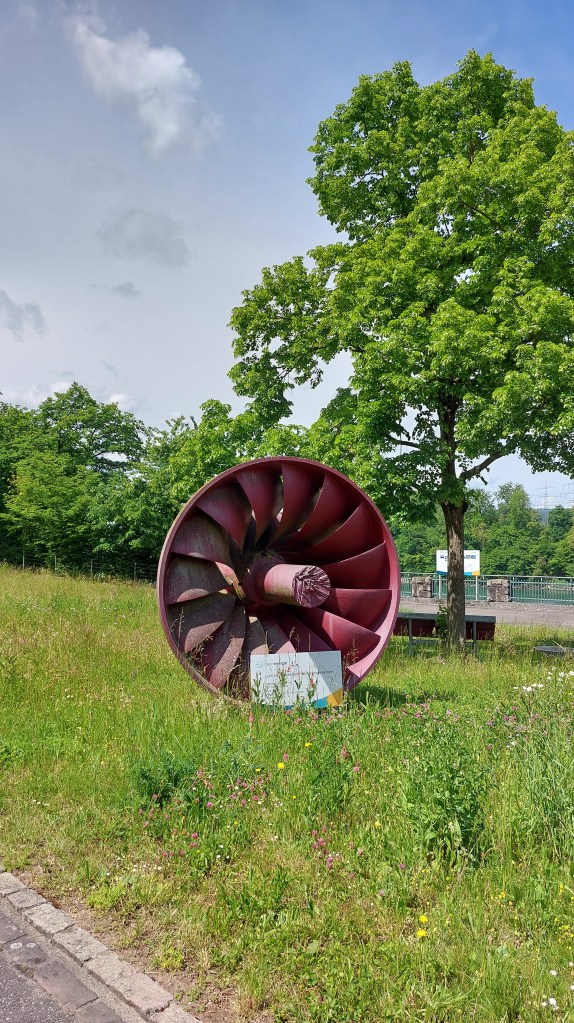
Continuando con el paseo de ese día, pasamos junto a la Rheinkraftwerk Laufenburg, la central hidroeléctrica más antigua construida en el Rin, entre 1908 y 1914, y la más potente de Europa en ese momento. Potente, ocupa el espacio entre una margen y otra del río. Detrás suyo no puede verse nada. Se impone en el paisaje fluvial. Caminando cerca de ella se leen advertencias: cuidado en las orillas con posibles subidas rápidas del nivel del agua.
Cerca de allí vimos torres de electricidad del lado alemán y el cielo cubierto por cables que unen ambos países. Paloma nos dijo que a Suiza le llega mucha electricidad desde Alemania. También vimos bunkers, como en cada caminata desde que llegamos al Rin.
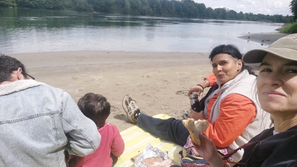
Entre el sendero que se adentraba en el bosque y el sendero de la orilla del río (Uferweg) elegimos este último por ser un poco más transitable con el carrito. En la costa encontramos una playita natural donde hicimos parada y picnic, echando previamente a unos cisnes interesados en nuestras viandas. Cuando retomamos la marcha, hubo tramos en los que fue necesario que Remo caminara y que nosotros carguemos el carrito a cuestas porque se tornaba difícil moverlo. Por suerte, el pequeño participó activamente de esta caminata. Fuimos, por este motivo, con un ritmo lento.
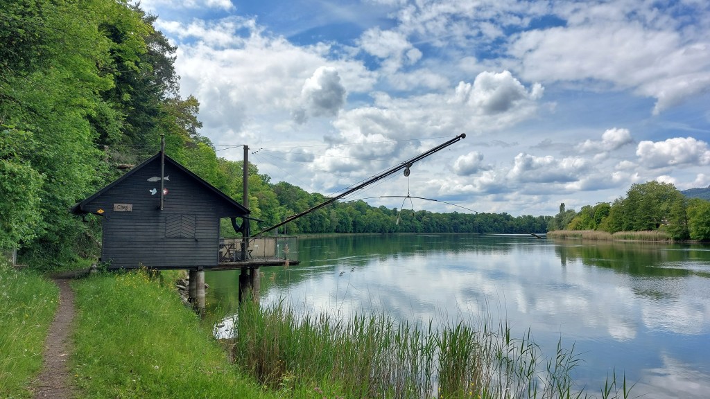
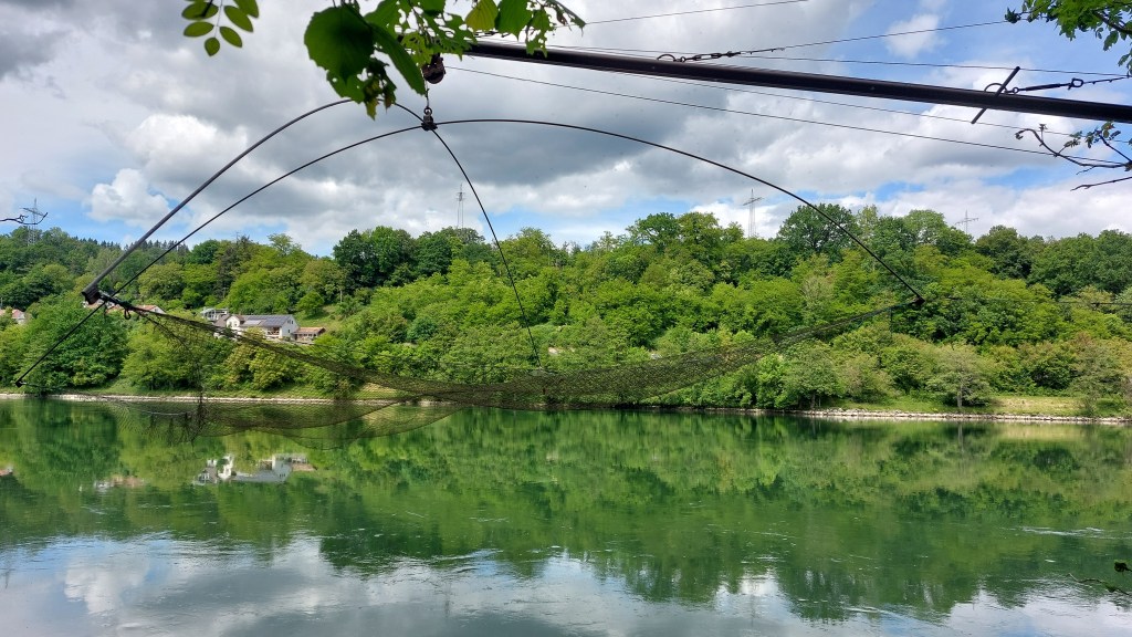
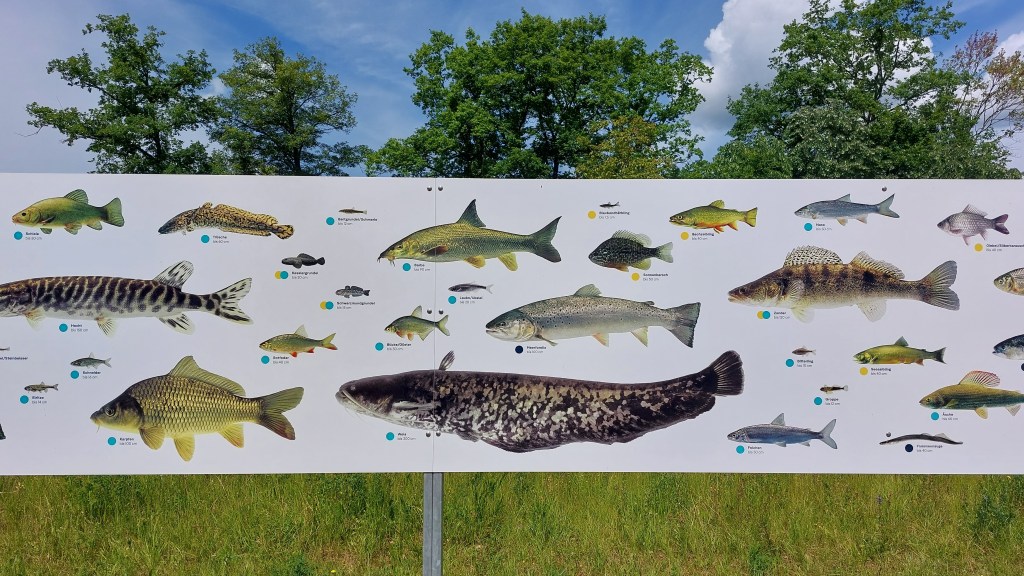
Vimos varias cabañas de pescadores, cada una con una larga caña para poner redes y pescar. A ninguna le faltaba su parrilla para cocinar el botín de pesca. Se veía claramente su función: juntarse, pescar desde la tierra, comer.
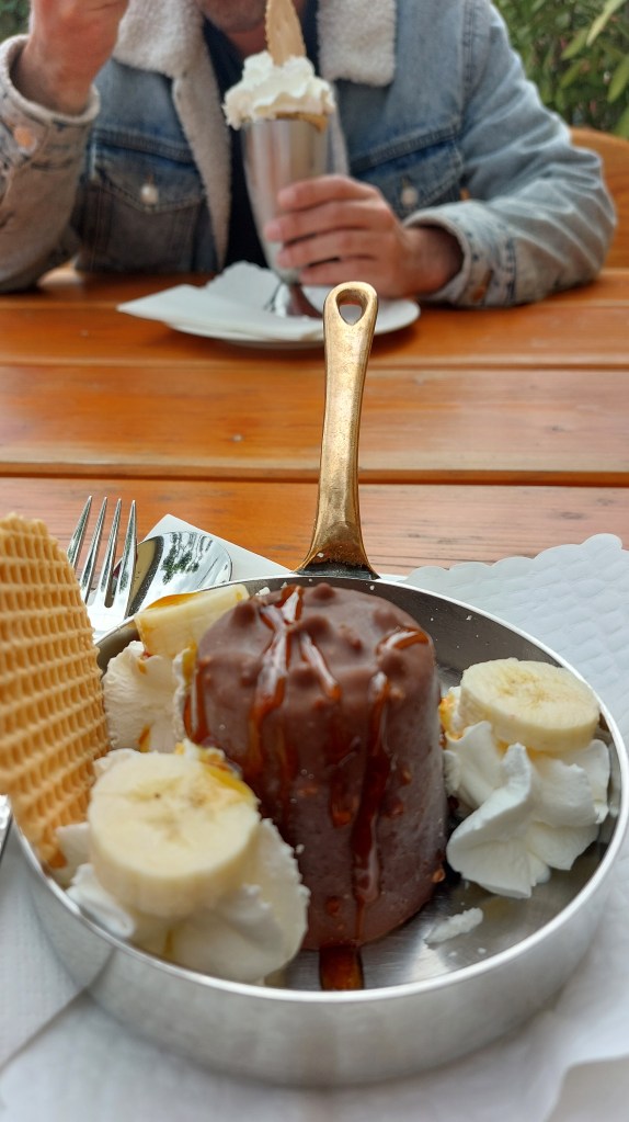
Ya medio cansados y acalorados, sobre todo por arrastrar el carrito, y con Remo dormido, llegamos a Sisseln, donde decidimos terminar la caminata aún si pensábamos llegar un poco más lejos. Nos sentamos en el restaurant Pinte donde nos tomamos unos bastante merecido refrescos y dulces mientras fantaseamos con posibles festejos en la llegada a Basel y fijamos que como máximo, tenemos que terminar este proyecto al cumplir los diez años de paseos. Luego emprendimos juntos la vuelta en bus y en tren hasta Baden y Zürich.
ENG
We arrived at the station, and Tom, Remo, and I met up with Paloma, with whom we set off for Laufenburg, where we had finished our walk a year earlier. This time, we were able to explore part of the medieval town, marveling at its buildings, though always looking for the river. When we reached it, our walk began.
Once again, the journey was shaped by the fact that we were traveling with a stroller. In Laufenburg, there were some wheelchair-accessible paths that we were able to enjoy. But afterward, we encountered difficulties. These days I have been reading the book “Andar por andar” by Adriana Herreros, in which she writes: “Walking areas (…) in rural environments shrink dramatically as urbanization, highways, and various infrastructures advance” (translation is mine). It made me think about how difficult it is to get around with a small child outside the city, on trails that are not accessible. On the one hand, I think it is positive to preserve natural areas between towns, that there is no need to turn every place into a designated trail, and that it is good for some spaces to remain untamed—or at least aspire to be. Narrow, immersive paths. However, it is undeniable that these spaces are crossed by paved roads, without sidewalks, built only for cars. By car, you can get anywhere. By car, you can travel this route along the river. Whenever we walked, there was always a road more or less nearby. But with a child’s stroller, things become more complicated. So I wonder whether, given the infrastructure available for cars, a slightly wider and somewhat smoother path would not be enough to allow people with strollers to walk along the Swiss side of the river as well. I wonder that only because I still want to walk and explore having a kid.
Continuing our walk that day, we passed by the Rheinkraftwerk Laufenburg, the oldest hydroelectric power plant built on the Rhine, constructed between 1908 and 1914, and at the time the most powerful in Europe. Powerful indeed—it occupies the space from one bank of the river to the other. Nothing can be seen behind it. It dominates the river landscape. Walking nearby, one reads warnings: be careful along the banks because the water level can rise rapidly.
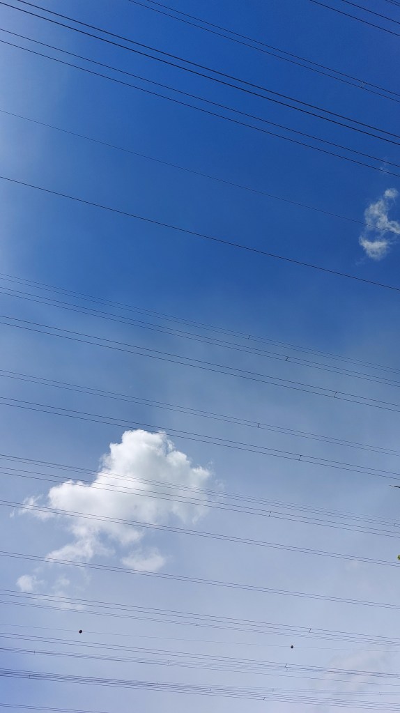
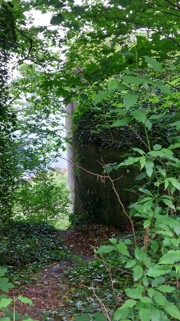
Near there we saw electricity pylons on the German side and a sky crisscrossed by cables connecting the two countries. Paloma told us that a a lot of electricity comes from Germany. We also saw bunkers, as we have on every walk since arriving at the Rhine.
Faced with the choice between the trail that disappeared into the forest and the riverside path (Uferweg), we chose the latter because it was a little easier to manage with the stroller. Along the shore we found a small natural beach where we stopped for a picnic, after first shooing away some swans that were interested in our provisions. When we resumed walking, there were stretches where Remo had to walk and we had to carry the stroller because it became too difficult to push. Fortunately, the little one participated actively in this walk. For that reason, we moved at a slow pace.
We saw several fishermen’s huts, each with a long pole used to set nets and catch fish. None lacked a grill for cooking the day’s catch. Their purpose was clear: gather together, fish from the shore, and eat.
Already somewhat tired and overheated—especially from dragging the stroller—and with Remo asleep, we reached Sisseln, where we decided to end the walk even though we had intended to go a little farther. We sat down at the Pinte restaurant and enjoyed some quite well-deserved soft drinks and desserts while fantasizing about possible celebrations upon reaching Basel. We also agreed that, at the latest, we must finish this project by the time we reach ten years of walks. Afterward, we made the journey back together by bus and train to Baden and Zurich.


Leave a comment